Deliverables
What We Build
Geospatial web applications
When teams need to see, search, or share location-based information, a simple web map or dashboard is often more useful than another static report.
We build browser-based tools that connect to live data and make the information easier to use for staff, field teams, managers, or the public. The goal is not a bloated software platform; it is a focused application that helps people answer the question in front of them.
Example:
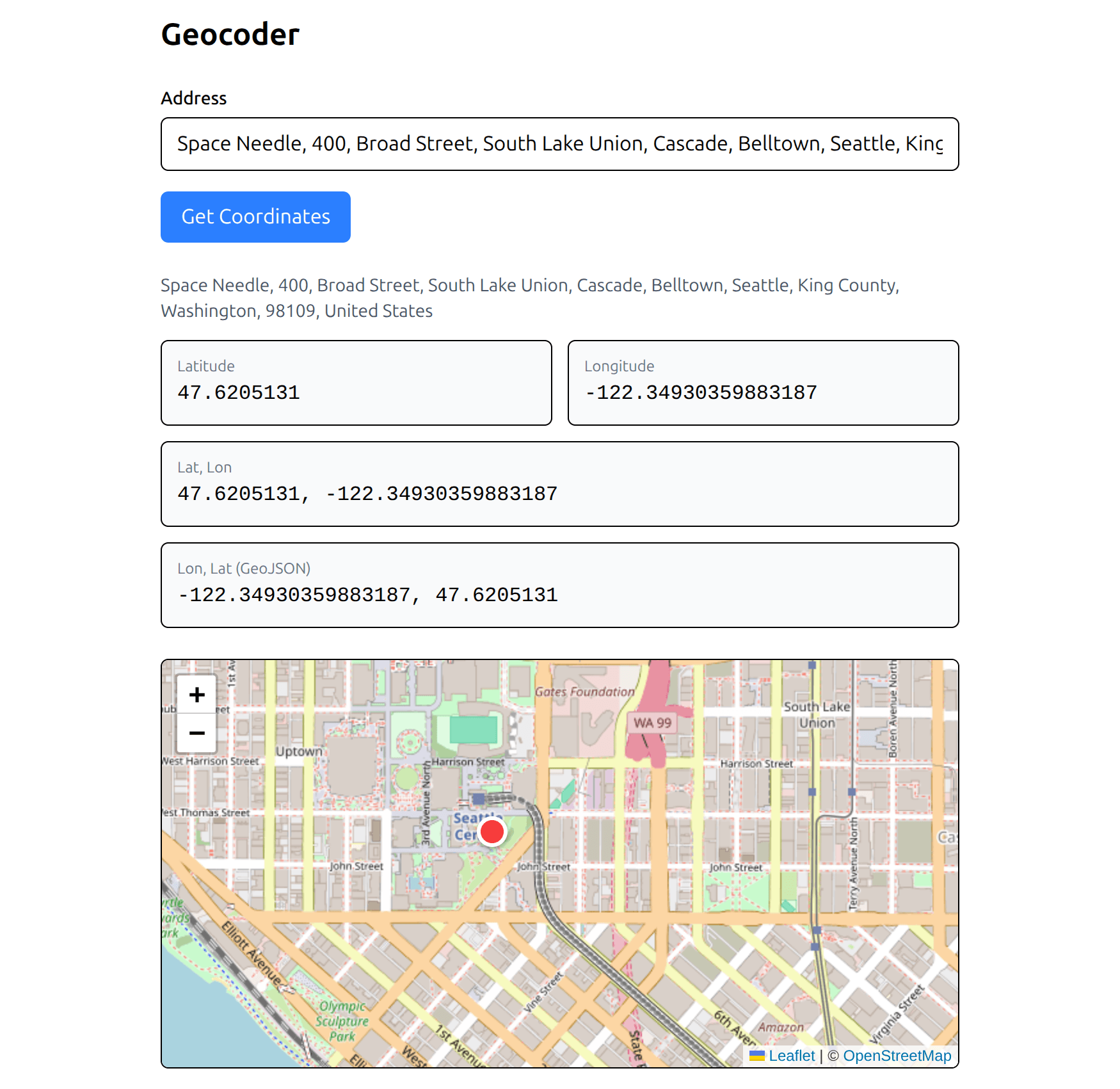
A reusable geocoder with a simple UI
We built this so routine geocoding does not have to depend on paid API calls, and so the same endpoint can power other Thorn Street applications. The geocoding service is self-hosted, with an API we control. The UI gives us a friendly way to run one-off checks, confirm on the map, and copy coordinates.
Why it matters
Owning the spatial data layer gives teams more control over cost, speed, and how the work gets done.
- Enter a locationStaff enter an address, asset, parcel, or other location record.
- Call the endpointThe UI uses the same geocoder our other apps can use.
- Use the resultCoordinates are ready for GIS, scripts, dashboards, or reports.
- Check the mapThe map preview makes it easier to catch a bad match.
This is the kind of spatial infrastructure and web interface we build for other teams.